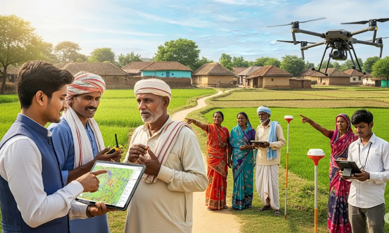
- SVAMITVA Scheme helps citizens map their own land using advanced technology.
- Use of AI and Machine Learning improves land records and mapping accuracy.
- International partnerships make SVAMITVA a global example of citizen-focused governance.
SVAMITVA Scheme is changing how land mapping and governance work in India by letting landowners map their properties themselves with the latest technology. This scheme, praised by Science and Technology Minister Dr. Jitendra Singh, is getting attention worldwide for its citizen-focused approach and smart use of AI and Machine Learning. It is set to improve land records and help with better planning in both cities and rural areas.
Helping Citizens Through SVAMITVA Scheme
The SVAMITVA Scheme lets property owners play an active role in mapping their land, cutting down the need to rely on old revenue systems. This not only makes land ownership paperwork easier but also helps solve property disputes faster. By giving people the tools to map their land accurately, the scheme builds clarity and trust in land records.
Technology Advances in SVAMITVA
The core of the SVAMITVA Scheme is the use of advanced technologies like Artificial Intelligence (AI) and Machine Learning. These tools improve the accuracy and trustworthiness of land records by handling high-resolution mapping data. The Survey of India supports this by offering technical help and updating mapping technology to meet current standards.
International Partnerships and Influence
The SVAMITVA Scheme has caught the eye of other countries, leading to agreements with places like Russia and Nigeria. Six more agreements are being worked on, showing the scheme’s potential as a global example of citizen-focused governance. These partnerships aim to share knowledge and best methods in land mapping and geo-spatial technology.
Also Read – Retirement Age Hike for Central Government Employees – Eligibility, Benefits, and Current Status
Plans Ahead for SVAMITVA Scheme
Looking forward, the government plans to finish detailed topographical mapping by 2030. This will include reaching a resolution of 5-10 cm for urban and rural areas and 50-100 cm for forests and wastelands. Expanding geo-spatial abilities will further improve land management, city planning, and environmental protection across the country.
Dr. Jitendra Singh has also suggested a national workshop to show how the Survey of India has changed from making traditional maps to becoming advanced geo-spatial helpers. This event will highlight the Survey’s role in supporting major projects like AMRUT, Smart Cities, and NAKSHA, showing how important the SVAMITVA Scheme is in India’s growth story.